September 4, 2023
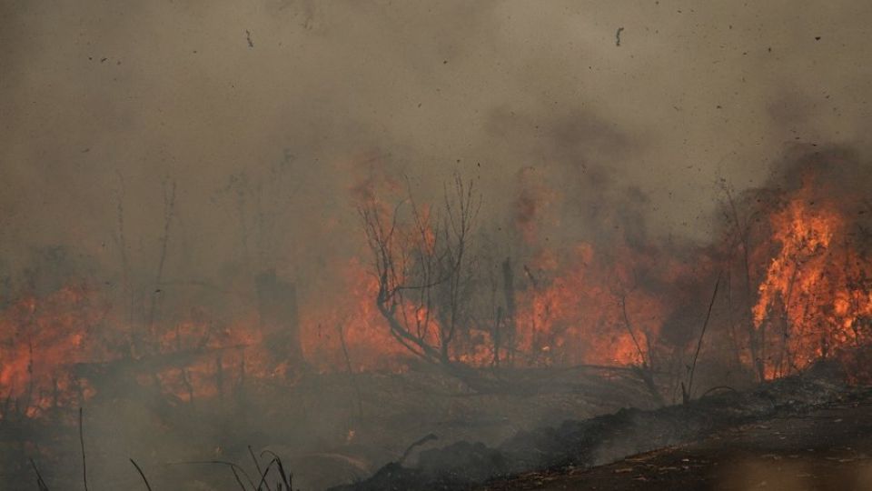
BANGKOK – Indonesia is battling an increased number of wildfires, and the haze they bring, as the dry season, which is expected to peak this month, intensifies across the country.
The Meteorology, Climatology and Geophysics Agency (BMKG) warned that the country is expected to see less rainfall this year because of the El Niño climactic phenomenon, which brings hotter and drier weather to the Indonesian archipelago and prolongs the dry season.
The exacerbated dry season, which the BMKG estimates will peak between August and September, leads to a higher risk of wildfires. The country has seen 490 land and forest fires as of Saturday, according to the National Disaster Mitigation Agency (BNPB), more than three times the 160 fires that were recorded in 2022.
Data from the Environment and Forestry Ministry has shown that Central Kalimantan, one of the most fire-prone regions, has recorded 202 forest and land fires this year, which have burned almost 3,000 hectares. It is among the provinces that declared a state of emergency in May because of the wildfires.
Palangkaraya, the provincial capital and largest city of Central Kalimantan, has recorded 87 forest fires since the start of the dry season, the local disaster agency reported.
Several fires can break out at different locations at once, including near residential areas, making efforts to extinguish them challenging because of limited firefighting personnel and drought-induced restriction of the water supply.
“The fires bring a thin haze that blankets Palangkaraya, especially during the morning and afternoon. Residents will smell a burned aroma during a wildfire,” Palangkaraya disaster mitigation agency (BPBD) official Heri Fauzi said as quoted by Antara.
The worsening air pollution from the fires has forced the Palangkaraya education agency to instruct students and teachers of kindergartens, elementary and junior high schools to wear masks while at school. Schools were also ordered to limit outdoor activities.
“The poor air quality may affect students’ health, so we require them and teachers to wear masks while doing activities in classrooms,” said Palangkaraya education agency head Jayani.
Another fire-prone area in Central Kalimantan, East Kotawaringin regency, has also scrambled to put out fires that engulf it. The local BPBD officials said their job was hindered by the lack of personnel and tools to fight the fires which have burned 500 hectares of land since May, as reported by Tribun Kalteng.
Located about four hours from Palangkaraya by car, East Kotawaringin is one of the areas that was most affected during the 2015 and 2019 wildfires that engulfed the country and are considered some of the worst forest fires in decades.
In those two years, fires burned thousands of hectares of land across the country, creating a haze that negatively affected the health of people in Indonesia and neighboring countries. The World Bank estimated the 2019 wildfires caused about US$5.2 billion of economic losses in eight provinces.
Fires near new capital, tourist area
Some other provinces have also experienced wildfires this dry season.
A wildfire in Banggai regency in Central Sulawesi on Thursday burned 60 hectares of plantation area. Meanwhile, haze from peatland fires has shrouded Pontianak and Kubu Raya regencies in West Kalimantan since last month.
Authorities recently put out fires that engulfed at least 20 hectares of land in North Penajam Paser regency in East Kalimantan, near where the country is constructing its new capital city, Nusantara.
On Friday, there were 556 hot spots across the province, according to a BMKG station in Balikpapan. Hot spot are not necessarily fires, but they show the areas where satellites and other instruments record higher temperatures compared to the surroundings, which can indicate where forest and land fires occur.
Java is not exempt from wildfires and authorities have been scrambling to put out fires in Mount Bromo and Mount Arjuno-Welirang in East Java. Bromo authorities were forced to close off some tourist spots and trekking routes on Friday while firefighters tried to extinguish the fires.
In Sumatra, authorities launched cloud seeding operations to put out fires and dampen the land in Riau province to prevent fires from breaking out. The same technique will also be used in Jambi.
The Environment and Forestry Ministry showed that more than 2,200 and 150 hectares of land have been burned in Riau and Jambi, respectively, since the beginning of the year. Both provinces are among Sumatra’s most fire-prone areas.


