May 29, 2024
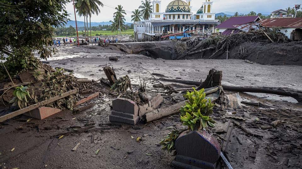
JAKARTA – Authorities have announced plans to develop an early warning system for flash floods and lahars in the vicinity of West Sumatra’s Mount Marapi, after disasters this month claimed more than 60 lives and destroyed hundreds of buildings in six regencies and cities of the province.
The Meteorology, Climatology and Geophysics Agency (BMKG) said it planned to install 23 instruments to monitor for possible flash floods or lahars – mudflows of volcanic debris – descending from the slopes of the volcano and warn residents living below.
Padang Panjang geophysics station head Suadi Ahadi said it was a challenge to predict hydrometeorological disasters based on river water levels alone.
The rivers around Mount Marapi, he continued, were mostly intermittent or seasonal with inconsistent water flow.
“That is why the tools will not only calculate flash flood risk based on the water level, but also on rainfall and ground vibrations. The alarm will sound when it detects incoming flash floods,” Suadi said recently, as reported by Antara.
Read also: Act now or many more will die
At the same time, the BMKG, the National Disaster Mitigation Agency (BNPB) and the Volcanology and Geological Disaster Mitigation Center (PVMBG) are planning to train a team of residents in each village surrounding the volcano to assist with any possible evacuation.
The so-called “community-based early warning system” is not the first to be implemented in the country.
In 2012, the BNPB issued guidelines for such a system that outlined the early warning system’s structure within the community, detailed evacuation procedures and called for evacuation maps to be developed for disaster-prone areas.
People living near the similarly named but distinct Mount Merapi in Yogyakarta are among those who have adopted the system.
“Communities surrounding Mount Merapi have actively formed emergency teams to alert about potential lava flows. They communicate through handled transceiver [HT] radios. Similar [procedures] have also been adopted by those living on Mount Semeru [in East Java],” PVMBG head Hendra Gunawan told Kompas.id.
Read also: Jokowi orders faster rebuilding of damaged infrastructure in disaster-hit West Sumatra
Ade Edward, a member of the West Sumatra branch of the Association of Indonesian Geologists (IAGI), said people living near Mount Merapi were generally “more trained” in facing such hydrometeorological disasters.
Merapi’s lava flows cause fewer fatalities than Marapi’s, Ade continued, despite the former’s greater eruption volumes and intensities, thanks to the implementation of the community-based early warning system.
Shortly after this month’s Mount Marapi disasters, Coordinating Human Development and Culture Minister Muhadjir Effendy said they could have been avoided if the government had a better mitigation system.
The Meteorology, Climatology and Geophysics Agency (BMKG) confirmed separately that the West Sumatra government had no early warning system in place for the province’s frequent flash floods and lahars.
West Sumatrans even have their own term to describe lahars: galodo.
A particularly destructive galodo occurred in April 1979, killing at least 60 people and destroying five villages in the regencies of Agam and Tanah Datar.


