September 8, 2025
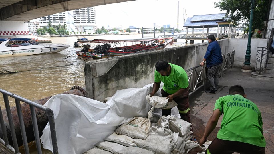
BANGKOK – Bangkok is facing a compounding flood crisis that could see most of the city submerged by 2030, according to a stark warning from a leading environmental academic.
Writing on social media, Dr Sonthi Kotchawat of the Thai Environmental Scholars Association outlined the key factors behind the worsening situation, arguing that the city’s flood management strategy requires a complete overhaul.
The Current Crisis
Geographical Vulnerability
The Thai capital is built on a low-lying delta, sitting just one metre above average sea level. While its eastern side and parts of neighbouring Samut Prakan serve as a natural drainage route to the Gulf of Thailand, the area is sinking by approximately one centimetre each year.
This land subsidence is being exacerbated by rising sea levels, which are climbing by an average of 3-5 millimetres annually due to global warming and melting polar ice caps.
Dr Kotchawat warned that without concrete measures to reduce carbon emissions, seawater could inundate the Chao Phraya River and its canals by 2030, flooding a significant portion of the city.
Extreme Weather
A global temperature increase of just one degree Celsius could lead to a 7% rise in rainfall across the Bangkok metropolitan area.
The city is already experiencing more frequent and intense downpours, with rainfall sometimes exceeding 100 millimetres in a single day, particularly when the southwest monsoon brings moisture from the Indian Ocean.
Strained Drainage Systems
Bangkok’s current drainage system can only handle up to 60 millimetres of rain per hour. When rainfall exceeds this capacity, widespread flooding occurs.
The problem is worsened by canals that have become clogged with rubbish and are too shallow to effectively drain water, with high tides making it almost impossible to flush water out into the Gulf of Thailand.
Vanishing Floodplains
Over the last 20 years, Bangkok has lost a significant amount of its natural “monkey cheeks,” or water retention areas, to urban development.
These crucial floodplains on the eastern side of the city have been replaced by housing estates and large-scale projects, including Suvarnabhumi Airport, which covers an area of more than 20,000 rai.
The report states that the city’s water retention areas have shrunk from an original 92,000 rai to just 34,000 rai in districts such as Khlong Sam Wa, Nong Chok, Min Buri and Lat Krabang—a loss of over 58,000 rai.
Recommended Solutions
Dr Kotchawat proposed several solutions to mitigate the looming crisis:
Integrated Management: Flood management should be overseen by a single national body, such as the Office of the National Water Resources (ONWR), rather than being handled separately by individual provinces. This would allow for a unified, system-wide approach to water drainage.
A “Water Highway”: The creation of a dedicated waterway to channel floodwater directly from Pathum Thani, Rangsit, Bangkok, and Samut Prakan to the Gulf of Thailand is recommended.
Delta Works-Style Project: The academic suggested building large-scale structures such as dams, sea walls, floodgates, and pumping systems, similar to the Netherlands’ famous flood defence model, to prevent seawater from entering the city’s waterways.
Capital Relocation: As a last resort, if the situation becomes unmanageable, Dr Kotchawat suggested the government should consider relocating the capital, mirroring Indonesia’s decision to move from Jakarta to Nusantara to escape similar issues.