
November 12, 2025
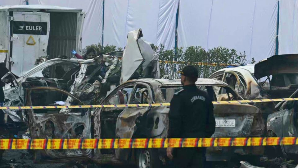
NEW DELHI – Investigators have pieced together a nearly 11-hour-long route map of the Hyundai i20 that was ripped apart by a powerful explosion near the Red Fort on Monday evening, revealing a meandering path that started in a neighboring city and ended in the heart of the capital.
The breakthrough came from an extensive analysis of CCTV footage from multiple locations, which allowed the police to track the vehicle’s movement from its origin in Faridabad, Haryana, to the final blast site.
According to the timeline reconstructed by the police, the car was first captured on camera outside the Asian Hospital in Faridabad at approximately 7:30 am on Monday. From there, it began its journey towards Delhi.
The vehicle crossed the Badarpur toll plaza and entered the national capital at 8:13 am. Just seven minutes later, at 8:20 am, it was spotted near a petrol pump in the Okhla Industrial Area.
The footage then shows a significant gap in the timeline, with the next sighting occurring almost seven hours later. The car entered the parking area near the Red Fort complex at 3:19 pm, where it remained stationary for nearly three hours.
At 6:22 pm, the vehicle exited the parking lot and headed towards the Red Fort. Just 24 minutes later, at 6:52 pm, a massive explosion tore through the interior of the moving car, sending shockwaves through the high-security zone.
The detailed route map is a critical piece of evidence for the probe agencies, who are working to identify the occupants of the car and establish the motive behind the blast. The nearly three-hour halt in the parking lot and the long, unexplained gap in the vehicle’s movement between Okhla and the Red Fort are now key focus areas for investigators.
Forensic teams are examining the remnants of the vehicle for clues, while intelligence agencies are scanning the recovered route against other threat perceptions.
The case has been handed over to the elite NIA.