May 8, 2025
TOKYO – The government plans to enhance its surveying and research activities on remote border islands using lasers to analyze topographical changes, with the aim of preserving such islands.
It plans to begin using laser-based surveying in the current fiscal year and to develop a “topographical matching system” by fiscal 2026 which will allow for the automated comparison of topographical changes.
This initiative aims to promptly ascertain the impact of erosion and other factors to ensure the maintenance of Japan’s territorial waters and exclusive economic zone (EEZ).
The Cabinet Office and the Geospatial Information Authority of Japan are planning to collaborate on the survey to collect topographical data on all 473 of Japan’s remote border islands by fiscal 2028. The survey will include aerial photography.
Border islands serve as crucial baselines for Japan’s territorial waters and EEZ. A country’s territorial waters, over which it exercises sovereignty, extend about 22 kilometers from its coast. A country’s EEZ, in which it has preferential rights for activities like fishing and natural resource exploitation, extends up to 370 kilometers from the coast.
Previously, surveys of border islands visually compared aerial photographs and satellite images, taken roughly every 10 years, and conducted on-site inspections to verify topographical changes.
GRAPHICS: THE YOMIURI SHIMBUN
Moving forward, aerial photography will be stepped up to five-year intervals. Furthermore, more detailed data will be obtained through laser surveys for about 25 islands that are particularly susceptible to erosion from wave action and other elements.
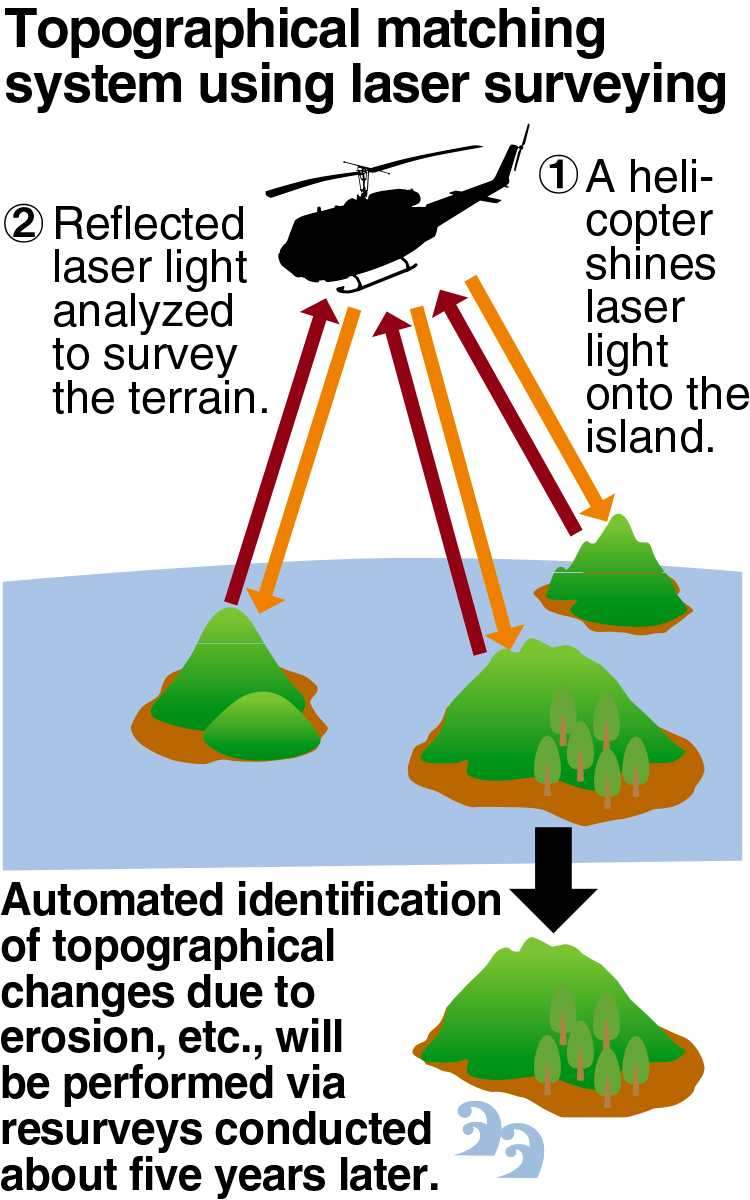
In laser surveying, a helicopter shines laser light onto islands, and the precise shape of the landmass is determined by analyzing the reflected light.
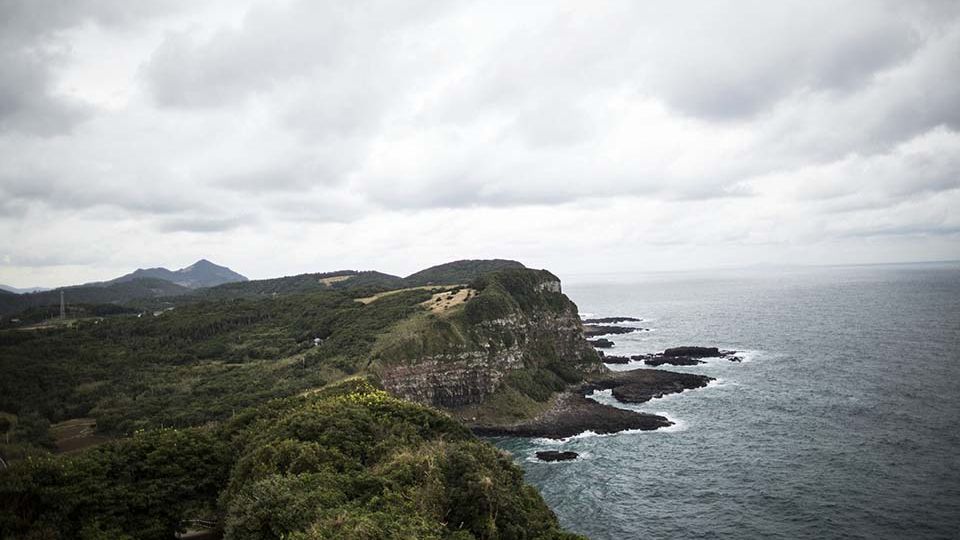
The survey will focus on islands such as Kita-Kojima, Naka-Kojima and Minami-Kojima, which collectively constitute the Hizen-Torishima islands in Goto, Nagasaki Prefecture. Situated in the East China Sea, this area is characterized by abundant fishing grounds.
The new system will accumulate data from photographs and laser surveys and automatically compare it with data from subsequent surveys conducted about every five years. This process will objectively measure topographical changes and erosion indicators.
Early detection of changes will allow for the timely start of conservation work to protect the islands. For example, seawall construction has been implemented at Okinotorishima Island, Japan’s southernmost point, to combat erosion.
The significant distance of remote border islands from the mainland often results in delays in determining their actual state. The government’s decision to increase surveying efforts is in response to a series of cases in which the disappearance of islands has been confirmed.
Esanbe-Hanakita-Kojima Island, located off Sarufutsu, Hokkaido, became submerged in 2018 due to erosion caused by waves and drift ice. In 2023, the government concluded that the island no longer met the criteria to be considered an island.
The government had previously cataloged 484 border islands nationwide. In its 2023 survey results, however, it announced a net reduction of 11 islands, reflecting the loss of 14 islands and the addition of three islands.
“Losing remote border islands would shrink Japan’s territorial waters and EEZs, which could harm our maritime interests, including fishing grounds and seabed resources,” a Cabinet Office official said.

GRAPHICS: THE YOMIURI SHIMBUN