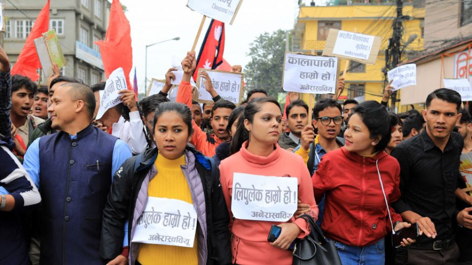
November 7, 2019
In a press statement, the Foreign Ministry refers to media reports and commentary before asserting that the matter would be resolved diplomatically.
The KP Sharma Oli administration on Wednesday said that its attention had been drawn to news and commentary regarding the placement of Kalapani on a new political map released by India.
Refraining from commenting directly on India’s new map, the statement, released by the Ministry of Foreign Affairs, says, “The Nepal government is clear about Kalapani being part of Nepal’s territory.”
The Post first reported on Monday that the new political map—released after India formally split up the disputed Jammu and Kashmir state into two federal territories—has placed the territory of Kalapani within its borders.
The Foreign Ministry statement on Wednesday came after a briefing by a Survey Department team led by its Director-General Prakash Joshi to secretaries from the Ministry of Foreign Affairs, Ministry of Home Affairs, and Ministry of Land Reform and Management.
At least two officials familiar with developments told the Post that it was surprising that the Foreign Ministry had issued a statement specifically mentioning media reports, despite being briefed on the matter by the Survey Department.
“Government secretaries were clearly briefed that some parts of Nepali land, including Kalapani, have been placed inside Indian borders in India’s new political map,” an official told the Post on condition of anonymity, citing the sensitivity of the matter.
“During the meeting, all three secretaries were convinced of the gravity and sensitivity of the issue and decided to immediately raise it with India through diplomatic channels,” said the other official. “The Foreign Ministry cannot issue a statement based on media reports because it has already been briefed by the concerned officials.”
The Survey Department had informed the government secretaries that the time had come to bring up the Kalapani issue with India via political and diplomatic channels.
“India has maintained its own ‘status quo’ while carving its boundary with Nepal. It’s time to address it,” an official familiar with the briefing said, describing the conversation between Survey Department officials and the government secretaries.
The third meeting of Nepal-India Joint Commission at the foreign minister-level in 2014 agreed to form a joint panel at the foreign secretary-level to resolve boundary disputes in Susta and Kalapani between Nepal and India, but no progress was reported at the last joint commission meeting held in Kathmandu in August.
Durga Prasad Bhattarai, a former foreign secretary, said that Nepal should invest more during times of calm to resolve the boundary crisis rather than becoming confused when a crisis appears.
“In peacetime, we have to take up the issue with whom we have disputes. If anything cannot be sorted out, we should clearly say that this issue remains unsettled. In certain cases, we can hold back because boundary disputes happen all over the world and they may not settle within a designated time. But we have to put the things forward in a transparent manner,” said Bhattarai.
Others pointed out that the statement is littered with errors. The statement, which is in Nepali, does not even have the name and designation of the undersigned, while the signature itself is unclear. As of press time, the statement had not been released in English, despite it concerning an international border issue.
The statement also makes no reference to Nepal’s claim over Limpiyadhura and Lipu Lekh, both areas which, in addition to Kalapani, have also been claimed as part of Nepali territory but are placed within Indian borders in the new map.
Pradhumna Shah, a former ambassador, said that it was not wise to release a press statement after something so critical appears in the media.
“In the past, the ministry has issued several statements repeatedly, correcting one after another. Whether it is SAARC or Venezuela or the Indo-Pacific Strategy, the Foreign Ministry has issued multiple statements after reactions and comments in the media,” said Shah. “The ministry should be consistent and it needs to respond before there is noise in the media.”
Shah, who served at the Foreign Ministry for a long time, said that if any crucial issue surfaces, the foreign minister or foreign secretary can immediately call upon their counterparts to voice their concern.
“It does India no good to maintain a boundary dispute with Nepal for such a long time as it only props up anti-Indian sentiment,” said Shah. “Nepal, on the other hand, should be proactive to settle the dispute because it is an important and sensitive issue for us.”
The Foreign Ministry, in its statement, has said that outstanding border-related issues between the two countries should be resolved mutually and that the Nepal government won’t accept any unilateral decisions.
“The Nepal government is committed to defending its international borders and is firm on its position that border problems between the two neighbouring countries should be resolved diplomatically, based on historical documents and concrete evidence,” says the statement. “Foreign secretaries of the two countries have been mandated to resolve border-related issues.”
Rajan Bhattarai, foreign relations advisor to Prime Minister KP Sharma Oli, told the Post that shortcomings from the government’s side in its immediate response could be because the concerned offices and officials did not have an “authenticated map”.
“If concerned officials have received the maps, they should be verified technically before making a position. Once officials find out the differences between the old and new maps, we have to raise the issue with India,” said Bhattarai. “It is our clear position that unilateral actions taken by anyone cannot be accepted.”
According to Bhattarai, Nepal’s diplomatic apparatus will take up the issue with India once the new map has been examined thoroughly. The map was uploaded on the official website of the Indian government’s Ministry of Home Affairs.


