
March 8, 2023
MANILA, Philippines — With a coastline stretching over 18,000 kilometers and coastal waters covering 266,000 kilometers, the Philippines has seen some devastating oil spills in previous years.
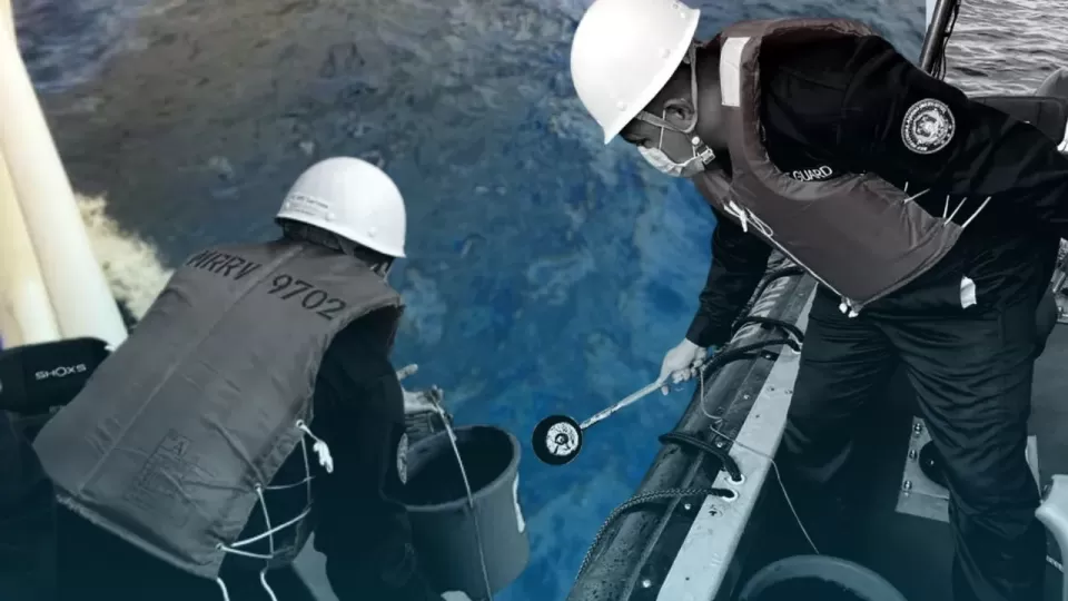
Last week, a tanker carrying 800,000 liters of industrial fuel capsized at Balingawan Point in Tablas Strait near Naujan and the island province of Marinduque after it experienced engine trouble.
On February 28, MT Princess Empress, bound for Iloilo from Bataan, began to sink after its engine overheated due to straining amid rough sea conditions.
The following day, the tanker plunged 460 meters below sea level.
According to the Philippine Coast Guard (PCG), the oil spill has already reached the island town of Caluya, between Mindoro and Panay. It has also been observed along the shoreline of Barangay Buhay na Tubig in Pola town.
Officials from several coastal towns of Oriental Mindoro have already declared states of calamity.
As government agencies and experts assess the extent of the damage caused by the oil spill from MV Princess Empress, INQUIRER.net looks back at some of the biggest oil spills in the country.
In the past years, similar spills—some even more significant and devastating—have threatened other parts of the country.
On August 11, 2006, strong winds and high waves battered the oil tanker MT Solar I off the southern coast of Guimaras while it was carrying 2 million liters of bunker fuel from Petron Corp. The tanker was on its way to Zamboanga City from Bataan when it was overcome by unusually rough waves.

GRAPHIC Ed Lustan
Known as the worst oil spill in the country’s history, the spill affected 1,500 hectares of the local ecosystem—including mangroves, seagrass, and coral reefs—and has severely affected the province’s marine resources, tourism industry, and economy.
According to The Manila Bay Oil Spill Contingency Plan, the largest oil spill that occurred in Manila Bay took place in Mariveles, Bulacan on July 1999, when MT Mary Anne spilled a total volume of 747,991 liters of oil.
A year before, in September 1998, MV Princess of the Orient was carrying around 600,000 liters of bunker oil and 11,000 liters of lubricating oil when it sank off Batangas and caused a massive oil spill in Manila Bay.
In August 2013, an aerial survey conducted by the PCG discovered that an estimated 500,000 liters of diesel spilled into the waters off Cavite, affecting at least four towns in the province (Rosario, Naic, Tanza, and Ternate).
Initial investigations pointed at the oil tanker MT Makisig as the source of the leak. Due to the damage caused by the spill, environmental advocates described the incident as “a repeat performance” of the “worst maritime oil disaster in the Philippines.”
Another massive oil spill hit Manila Bay in March 1999 when the tanker MT Sea Brothers sank in the bay while carrying 420,000 liters of bunker oil.
In December 2005, an oil barge of the National Power Corp. capsized off the shore of Semirara in Antique, spilling almost 200,000 liters of oil and contaminating about 40 square kilometers of water off Semirara.
Based on Greenpeace’s oil spill damage assessment, the oil spill affected over 100 hectares of mangrove and beach area and the island. The livelihood of at least 21 families likewise took a hit due to the spill.
More common than you think
Oil spills in Manila Bay, a key economic gateway where the majority of the country’s economic activities take place, are more common than some might think.
The Global Environment Facility (GEF)—United Nations Development Programme (UNDP)—International Maritime Organization Regional Programme on Building Partnerships in Environmental Management for the Seas of East Asia (PEMSEA) found that, on average, around 30,000 vessels enter Manila Bay each year.
“A majority of these vessels, which include tankers, passenger and cargo ships, either utilizes oil as fuel or carries it as their cargo. Ship-sourced pollution may result from either accidental or illegal operational discharge of these vessels,” the GEF-UNDP-PEMSEA explained.

GRAPHIC Ed Lustan
Oil spills could also occur during the process of loading and unloading petroleum products in the oil refineries within the bay. The depots found in Manila Bay’s shoreline include:
.Petron Depot in Rosario, Cavite, and LImay, Bataan;
.Total Depot in Tondo, Manila,and Mariveles; Bataan;
.Unioil Depot in Lucanin, Mariveles, Bataan;
.Jetti Depot in Naic, Cavite;
.Bataan Petroleum Terminal Inc. in Limay Bataan;
.Total Liquigaz in Barangay Alas-asin, Mariveles, Bataan.
“Aside from these depots that dot the Manila Bay coast, a large depot could also be found in Pandacan, Manila. Even though the depot is located inside the Pasig River and is kilometers away from the bay itself, the amount of petroleum stored in its tank farms could pose a significant threat to Manila Bay,” said GEF-UNDP-PEMSEA.
Historical data showed a total of 18 oil spills within Manila Bay from February 1998 to December 2004. Nine took place in the province of Bataan, in the ports of Limay and Mariveles, with a total volume of 789,751 liters.
Data also showed that most oil spills in Manila Bay occur where vessel traffic is heavy.
Understanding oil spills
Among the crucial parts of oil spill risk assessment involves identifying risk factors that may cause them.
According to The Manila Bay Oil Spill Contingency Plan, the risk factors identified in Manila Bay waters based on previously recorded spills include:
.collision
.grounding
.hazards to navigation
.unseaworthiness of vessels
.negligence and incompetence of the owner/operator, master, or crew
.improper stowage and control cargoes
.presence of oil terminals and depots
.aging of the fleet of vessels at sea
.size/type of vessel and operation
.heavy vessel traffic
Aside from listing the risk-causing factors, the assessment also listed other factors that may heighten the risk of oil spills.

GRAPHIC Ed Lustan
Some of the most common factors that impact the risk of oil spills from occurring are various shipping-related risks like:
.density and movement of ships
.concentration of fishing and tourist vessels
.areas that pose a high level of difficulty to safe navigation
.commercial cargo shipping size, frequency, trading patterns, and amounts of oil carried as bunker fuel
.oil tanker frequency, sizes, shipping patterns, and quantities shipped
.properties of oil shipped as cargo
.terminal or port design
.type or amount of oil carried
Environmental factors—including tidal flow, weather, current, wind temperature, sea state, and type of shoreline—could also increase the possibility of oil spills.
Other factors like future trends, the presence of oil terminals and depots, and the capacity and capability of the response team could also escalate the chances and dangers of oil spills, according to GEF-UNDP-PEMSEA.

GRAPHIC Ed Lustan
In terms of sources of oil spills, records from the PCG secured by the National Operation Center for Oil Pollution (NOCOP) found that vessels are the top sources of major spills in the country.
From 1975 to 2019, a total of 305 major oil spills involved domestic, local, and foreign vessels that were usually engaged in domestic or international trading.
“Vessels are sources of oil spill when they are involved in collision…grounding and the likes,” NOSCOP stated.
Power plants and power barges; shipyards; refineries, terminals and depots; oil exploration and production activities; offshore mining activities; and industrial and manufacturing activities are also listed as sources of oil spills.
In some cases, however, NOSCOP noted that “mystery” spills occur where the spiller or source of the spillage and leak is unknown.