January 25, 2022
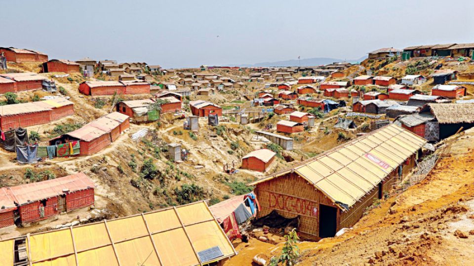
DHAKA – Around 6,000 Rohingyas should be evacuated from two camps in Cox’s Bazar to avert casualties as they are living on hilly slopes that are vulnerable to landslides, said a government report.
The Department of Environment (DoE) report said the hillocks of the camps, which have been razed by 75 to 90 degrees, are at risk of landslides, especially during the heavy rain expected in the coming monsoon.
For all latest news, follow The Daily Star’s Google News channel.
The report, prepared after a field visit on December 21, said around 6,000 people of 1,267 families are living on the slopes of hillocks at Camps 21 and 22 in Teknaf and should be evacuated from there before the next monsoon.
Refugee Relief and Repatriation Commissioner (RRRC) Shah Rezwan Hayat told The Daily Star that he was yet to receive the official order to act on the information but received a copy of the environmental assessment report.
“After receiving the copy and instructions, we will review the report and will take appropriate actions consulting with all stakeholders,” he said.
Hayat said Camp 21 is one of the most vulnerable to landslide among the Rohingya camps.
The Daily Star obtained a copy of the DoE report.
Md Ashraf Uddin, DoE director general, said they have already sent letters to the authorities concerned mentioning the report findings to take actions.
Local authorities and international aid agencies have long been warning about a looming natural disaster in the densely populated camps during monsoon.
According to RRRC office sources, six Rohingya refugees were killed due to landslides and flooding in the camps last year.
Over 7,00,000 Rohingyas, who crossed over into the coastal district fleeing persecution in Myanmar since August 2017, are dwelling in shacks made of thin bamboo and plastic sheets and too weak to stand heavy rains and storms.
The Rohingya camp in Cox’s Bazar is the world’s largest refugee camp as more than one million have been living in the 34 camps in the district since 2017.
The report said the total land area of Camp 21 is around 99.86 acre and the whole camp is located on hillocks.
A total of 16,000 families are living in Camp 21 and among them some 5,500 people are living in landslide-vulnerable areas on the slopes of the hillocks.
“Due to heavy rain, there is a chance of landslide in the coming monsoon … As drainage system is not proper, there is a chance of landslide and causalities,” the report said about Camp 21.
Regarding Camp 22, the report said it is spread over 112.56 acres with around 22,200 Rohingyas of 3,339 families living there. Among them, some 500 are living on the slopes of hillocks that are vulnerable to landslides.
“In Camps 21 and 22, around 6,000 Rohingyas of 1,267 families are living riskily on the hillock slopes and need to be relocated to a safer place,” the report said in its opinion portion.
Around 74,70,000 litres of water are required every day in the two camps built on forest department land.
“Opinion of the Department of Public Health Engineering is required on the groundwater layer,” it said.
The report mentioned that during the inspection they did not find any sewage treatment plant (STP) in those camps.


